On this page you will find additional information to help you use the site features to access data through
the National Geothermal Data System (NGDS)
Search Tool
The NGDS text search tool is the primary method for finding specific metadata records.
A full text search of NGDS metadata is performed for each search.
 Search TextBox Functions
Type Ahead - After entering 3rd character in the search textbox, typeahead terms will appear, allowing for autocomplete,
using NGDS keywords as source.
Search History - when the search textbox is in focus, the search history listbox appears with previous entered search terms (saved locally).
Note: Individual terms may be removed from the search history list by click on the "x" button in front of the term.
Doubleclick - clears textbox contents.
Return - is the same as clicking the search button.
Sort - by Modified Date, Relevance, Name ascending, Name descending
Clear - button will clear your search history
Saved - Show saved records
Search TextBox Functions
Type Ahead - After entering 3rd character in the search textbox, typeahead terms will appear, allowing for autocomplete,
using NGDS keywords as source.
Search History - when the search textbox is in focus, the search history listbox appears with previous entered search terms (saved locally).
Note: Individual terms may be removed from the search history list by click on the "x" button in front of the term.
Doubleclick - clears textbox contents.
Return - is the same as clicking the search button.
Sort - by Modified Date, Relevance, Name ascending, Name descending
Clear - button will clear your search history
Saved - Show saved records
Search Map Tool
The Search map provides location data for those records with location data included in the metadata
and allows users to search records by location.
 Viewing search results location data - when a text search is performed, any records on the currently selected page
with location info will appear in the map as a marker. Click on the location marker to display the Title,
clicking on the title will show the record detail page.
When mousing over search result records, each record will be highlighted in the map as it moused over.
Searching with the Map - Using map pan and zoom zoom functions, set the extent and center
of the search area location
of interest, then click on "Search using Map Extent" button to return results. Note: This returns only
records that have location info included in the metadata record.
Viewing search results location data - when a text search is performed, any records on the currently selected page
with location info will appear in the map as a marker. Click on the location marker to display the Title,
clicking on the title will show the record detail page.
When mousing over search result records, each record will be highlighted in the map as it moused over.
Searching with the Map - Using map pan and zoom zoom functions, set the extent and center
of the search area location
of interest, then click on "Search using Map Extent" button to return results. Note: This returns only
records that have location info included in the metadata record.
Facets - are preselected Search Topics
For each category only the item with the top 5 hits will appear in display,
except for catalogs, which displays all.
Facets selections appear for the current selected search results, if
searches have been run, facets appear for all data.
Authors - Filter results by publication Author
Data Types - Filter results by the data type of associated dataset.
Catalogs - Filter results by the originating collections for NGDS metadata records.
Content Models - are defined data formats for those records that include
geospatial data.
The full set of downloadable NGDS geospatial datasets can be found by clicking on the
AASG Geothermal Dataset button at the top of the home page. The definition of each content
model is provided. These models were defined during the NGDS design process and include:
Abandoned Mines
Active Fault/Quaternary Fault
Aqueous Chemistry
Borehole Lithology Intercepts
Borehole Lithology Interval Feature
Borehole Temperature Observation
Contour Lines
Direct Use Feature
Drill Stem Test Observations (deprecated)
Fault Feature / Shear Displacement Structure
Fluid Flux Injection and Disposal
Geologic Contact Feature
Geologic Fault Feature / Shear Displacement Structure
Geologic Reservoir
Geologic Units
Geothermal Area
Geothermal Fluid Production (deprecated)
Geothermal Metadata Compilation
Geothermal Power Plant Facility
Gravity Stations
Heat Flow
Heat Pump Facility
Hydraulic Properties
Mineral Recovery Brines
Physical Sample
Powell and Cumming Geothermometry
Powell Cummings Geothermometry
Power Plant Production
Radiogenic Heat Production
Rock Chemistry
Seismic Event Hypocenter
Thermal Conductivity Observation
Thermal/Hot Spring Feature
Volcanic Vents
Well Fluid Production
Well Header Observation
Well Log Observation
Well Tests
Search Record Detail Page
Displays all relevant data contained in the metadata record.
Title - Publication Title
Desciption - publication abstract
Data Links - clickable links that take you to the data. The system performs a
health check on the link, green indicating healthy, working link. Certain data types
are color coded for convience.
View XML/Json buttons - display the full metadata record in selected format in a new tab.
Keywords - clickable keywords included in the record. When clicked, performs a new search
using the selected keyword.
Author(s) of the publication, and additional details about the author.
Extent - geographic outline coordinates of the record, also displays the extent in the
search map.
Metadata - additional properties of the metadata record.
Versions - If the publication metadata has been modified, indicates the version display.
Search Result Records
Search terms and record count are provided at top. Use page arrows to browse through pages.
Records are displayed 10 records per page, showing metadata title, description,
and any links to data resources.
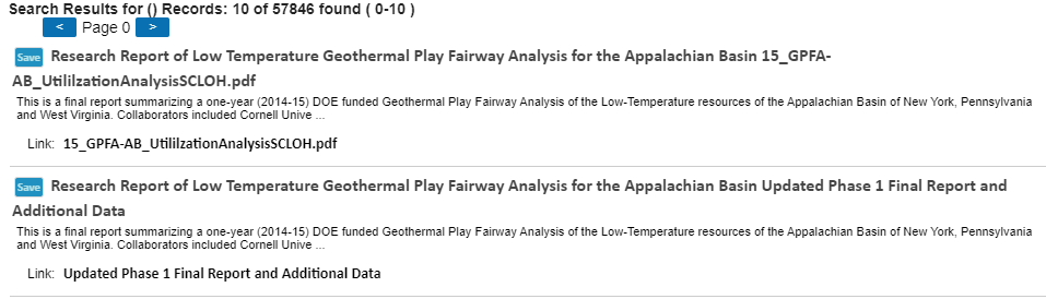 Click on the record Title will display the record detail page.
Select a link will open the target link in a new tab.
Mouse over a record will highlight location on map (if included in metadata).
Save will save the record locally, you can view your saved records by clicking the Saved
button underneath the search textbox. You can remove the saved record from your list by clicking
the Clear button for the record.
Click on the record Title will display the record detail page.
Select a link will open the target link in a new tab.
Mouse over a record will highlight location on map (if included in metadata).
Save will save the record locally, you can view your saved records by clicking the Saved
button underneath the search textbox. You can remove the saved record from your list by clicking
the Clear button for the record.